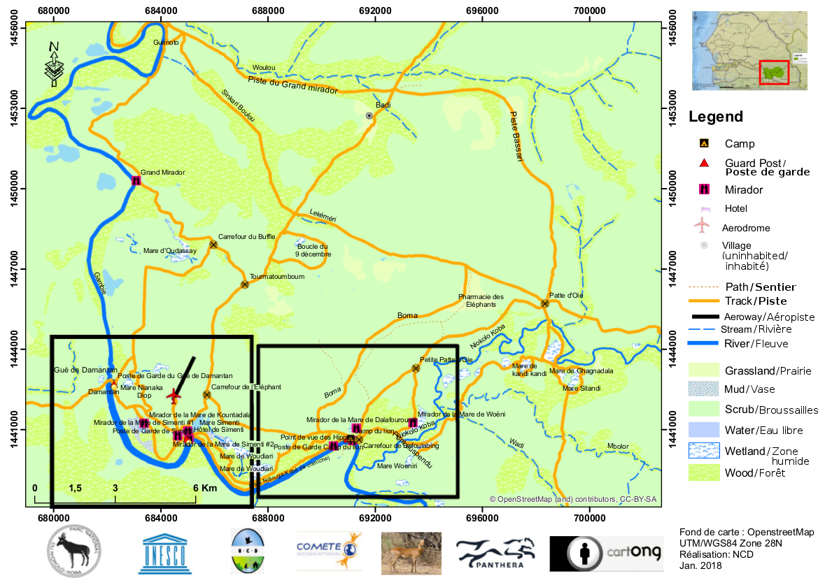
GIE NIOKOLO is in the process of developing an interactive map of Niokolo-Koba National Park with assistance from the Senegalese association Nature-Communauties-Dévelopment.
This work is being carried out with OpenStreetMap, a world map created cooperatively by ordinary citizens and available free of charge through an open data licence.
The map is still incomplete, but we hope that it can already be of assistance to visitors to the National Park. You can expore it on the OpenStreetMap website (navigate and zoom to obtain a detailed view, or find a specific place or point of interest).
We also provide routable versions for use on site which you can find download below for
— Garmin portable GPS units [1]:
or for
— the Android app Android OSMAnd [2]:
Visitors are invited to inform us about missing or erroneous information on the map, or to enter their own additions or corrections as OpenStreetMap participants.